MarineTraffic - Ship Tracking 4.0.102
Free Version
Publisher Description
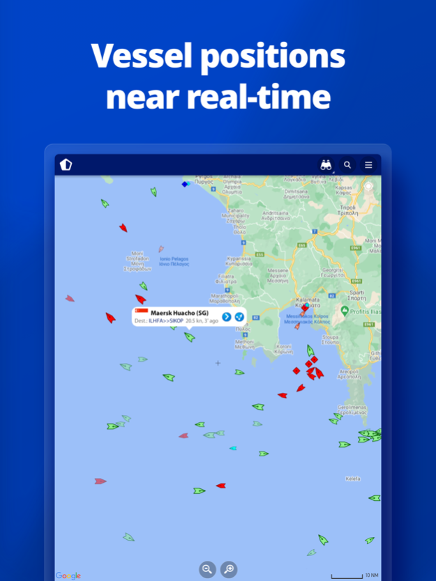
MarineTraffic displays near real-time positions of ships and yachts worldwide.
Using the largest network of land-based AIS receivers, the app covers most major ports and shipping routes.
• View VESSELS ON THE LIVE MAP, search for ships, boats and seaports and see what's near you!
• More than 300,000 VESSELS PER DAY report their positions via MarineTraffic AIS
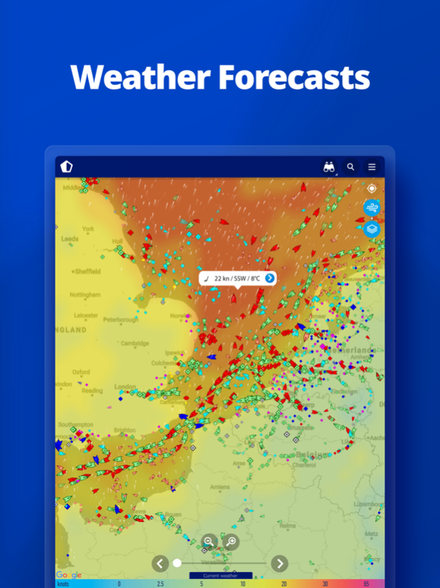
• View live wind and 48-hour WIND FORECASTS on the map
• ANIMATED PLAYBACK of vessel's track
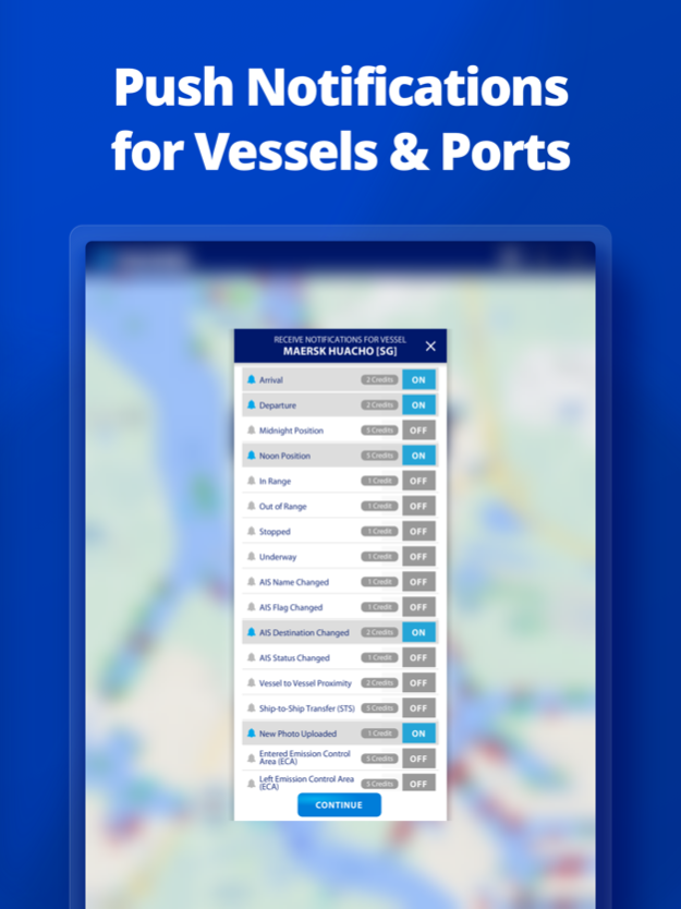
• PORT ARRIVALS & DEPARTURES live for over 4,000 ports and marinas, current conditions in ports and estimated time of arrival for the boats & ships.
• Manage your list of vessels ("MY FLEET"), shared with all your devices and MarineTraffic.com
• Browse 4.5 MILLION PHOTOS of ships, harbours, lighthouses and more!
• Upload photos to MarineTraffic directly from your device.
• Identify and track vessels sailing beyond the range of land-based AIS receiving stations, using satellite tracking, with ACCESS PLUS 24 (in-app purchase)
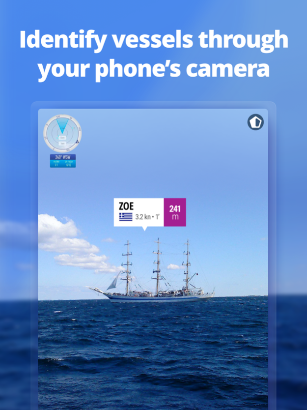
• Identify vessels around you at a glance with the AUGMENTED REALITY tool
Just point your device's camera to the horizon and get all the information you need about vessels, ports and lighthouses in your area: name, flag, speed, distance from you and a lot more.
• Use the ROUTE PLANNER tool to plan a route on the map, measure distances and calculate ETA
• MarineTraffic now offers auto-renewable subscriptions for Starter Plan, Nautical Charts, Weather Maps and Advanced Density Maps:
Starter Plan
- Unlock unlimited features like extended vessel and port details, vessel track, Advanced Search, Vessels near me, Augmented Reality and more
Subscription name: Starter Plan Annual
Cost: $9.99 (USD)
Renewed every year i.e. you will be charged annually
Get access to the marine environment with Nautical Maps
- Pilotage information such as sea bed, sea marks and landmarks
- Port details such as berths, dry docks and terminal location
- Position and characteristics of buoys, lights, lighthouses
- Depths of water and heights of land
Subscription name: Nautical Charts Monthly
Cost: $6.99 (USD)
Renewed every month i.e. you will be charged monthly
Subscription name: Nautical Charts Annual
Cost: $66.99 (USD)
Renewed every year i.e. you will be charged annually
Unlock real-time & forecast weather information with Weather Maps
- Wind contours
- Wind flow & gusts
- Temperature
- Wave metrics
- Clouds and Precipitation
- Ocean currents
- More than 20 key metrics
- 7-days sea meteogram
Subscription name: Weather Maps Layers Monthly
Cost: $8.99 (USD)
Renewed every month i.e. you will be charged monthly
Subscription name: Weather Maps Layers Annual
Cost: $95.99 (USD)
Renewed every year i.e. you will be charged annually
Advanced Density Maps
- Dig into global shipping traffic data, filtering by vessel type.
Subscription name: Advanced Density Maps Monthly
Cost: $1.99 (USD)
Renewed every month i.e. you will be charged monthly
Subscription name: Advanced Density Maps Annual
Cost: $17.99 (USD)
Renewed every year i.e. you will be charged annually
For all the above subscriptions:
• Payment will be charged to iTunes Account at confirmation of purchase
• Subscription automatically renews unless auto-renew is turned off at least 24-hours before the end of the current period
• Account will be charged for renewal within 24-hours prior to the end of the current period, and identify the cost of the renewal
• Subscriptions may be managed by the user and auto-renewal may be turned off by going to the user's Account Settings after purchase
• Any unused portion of a free trial period, if offered, will be forfeited when the user purchases a subscription to that publication, where applicable
Terms of Use: https://www.marinetraffic.com/en/p/terms
Privacy Policy: http://www.marinetraffic.com/en/p/privacy-policy
Join the great MarineTraffic community!
Mar 15, 2024
Version 4.0.102
- Additional viewing options in distant zoom levels
- Bug fixes and improvements
About MarineTraffic - Ship Tracking
MarineTraffic - Ship Tracking is a free app for iOS published in the Recreation list of apps, part of Home & Hobby.
The company that develops MarineTraffic - Ship Tracking is MarineTraffic Applications LTD. The latest version released by its developer is 4.0.102. This app was rated by 14 users of our site and has an average rating of 2.7.
To install MarineTraffic - Ship Tracking on your iOS device, just click the green Continue To App button above to start the installation process. The app is listed on our website since 2024-03-15 and was downloaded 1,094 times. We have already checked if the download link is safe, however for your own protection we recommend that you scan the downloaded app with your antivirus. Your antivirus may detect the MarineTraffic - Ship Tracking as malware if the download link is broken.
How to install MarineTraffic - Ship Tracking on your iOS device:
- Click on the Continue To App button on our website. This will redirect you to the App Store.
- Once the MarineTraffic - Ship Tracking is shown in the iTunes listing of your iOS device, you can start its download and installation. Tap on the GET button to the right of the app to start downloading it.
- If you are not logged-in the iOS appstore app, you'll be prompted for your your Apple ID and/or password.
- After MarineTraffic - Ship Tracking is downloaded, you'll see an INSTALL button to the right. Tap on it to start the actual installation of the iOS app.
- Once installation is finished you can tap on the OPEN button to start it. Its icon will also be added to your device home screen.
